 Ketchikan City Guide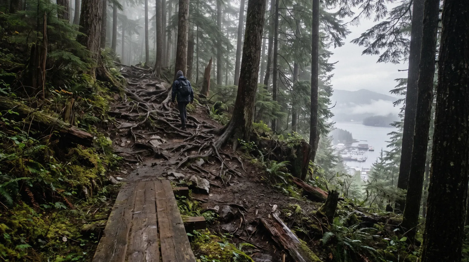
Deer Mountain Trail: Ketchikan's Steep Climb Above the Town
Hiking in Ketchikan starts and ends with the Deer Mountain trail, the National Recreation Trail that climbs straight up from the edge of town. It is the only hike on this site where you can leave a cruise berth on foot and be 2,000 feet higher within two miles. The route is steep, wet and free, with a shelter near the top. This page prints what the US Forest Service publishes and flags what it does not. The town all of this sits in is the Ketchikan guide at the foot of it.
Quick answer Steep free day hike from town, with an elevation conflict we name openly
The Deer Mountain trail is a free US Forest Service hike that starts about 0.5 mile up Ketchikan Lakes Road at the Nordstrom Drive junction. It gains roughly 2,000 feet in the first two miles and runs 10.7 miles in total to Upper Silvis Lake. Published summit figures conflict: the USFS trailhead page gives a maximum elevation of 3,350 feet, while Wikidata and USGS GNIS list the summit at 3,001 feet. We print both rather than pick one. There is no fee, no posted hours and no water at the trailhead. If you want a guided option instead, the e-bike and hike tour pairs cycling with a shorter walk.
Key takeaways
- The trail gains about 2,000 feet in the first two miles, so pace yourself from the first step of the trail.
- There is no entrance fee and no posted opening hours, because the route sits in Tongass National Forest.
- The trailhead has no restrooms or potable water, so fill bottles in town before you start.
- If 2,000 feet of climbing does not suit you, the rainforest sanctuary offers a flat guided walk instead.
Key facts
Opening hours
| Daily, all year, daylight only |
|---|
Planning it
- Time needed
- Not stated by the Forest Service. Our routing: three hours to a viewpoint and back
- Book ahead
- Optional — walk-up usually fine
- Address
- Not stated as a street address; trailhead reached via Ketchikan Lakes Road to the Nordstrom Drive junction
The trail costs nothing and needs no booking, which makes the official row the only one most readers need. The other rows are the guided walks people book when the gradient here is more than they want.
Two thousand feet of climb in the first two miles is the number that decides this page. If that is not your morning, the guided rows below are the rainforest without the gradient.
| Option | Price | Includes | Cancel | Book |
|---|---|---|---|---|
| Walk it yourselfAnyone who can walk uphill for two hours. This is the whole trail and it is free. | Free | The National Recreation Trail, 10.7 miles to Upper Silvis Lake | Nothing to cancel | Official site |
| E-Bike and Hike TourAnyone who wants a guided walk with the climbing done by a motor. | From $164 | Four hours, e-bike and hike, pickup available | See the operator listing | Check Availability |
| Alaska Rainforest Sanctuary and Totem Park WalkAnyone who wants rainforest without 2,000 feet of gain. | From $110 | 165 minutes, boardwalk through a private preserve | Free up to 24 hours before | Check Availability |
Published summit elevations disagree: 3,350 feet on the Forest Service trailhead page and 3,001 feet on another source. We print both rather than pick one.
Guided walking, if the gradient is too much
Four listings that put you in the same forest with less climbing. Prices, ratings and durations are the platform’s own figures.
 from $164
Pickup available
from $164
Pickup available Ketchikan: E-Bike and Hike Tour
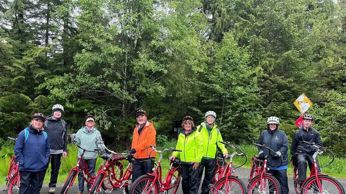
Riders pedal e-bikes eleven miles to the edge of the road system, then hike into the Tongass National Forest to a waterfall. The day ends with smoked salmon at the marina, a fit for visitors wanting light exercise over a bus tour.
Check Availability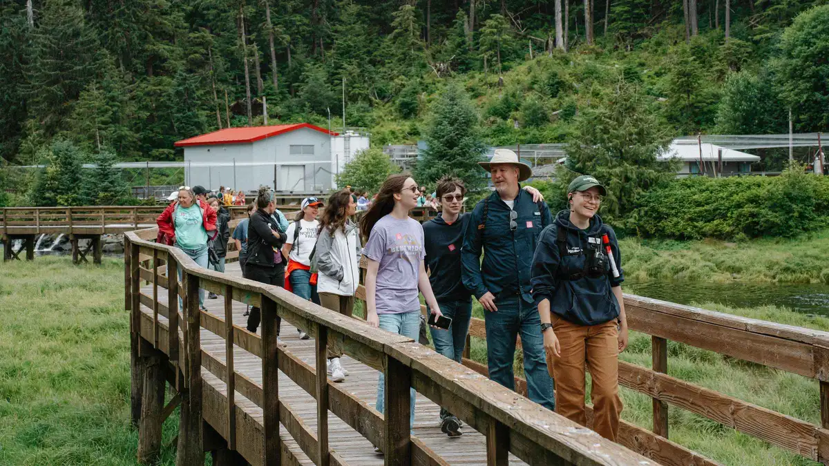 from $110
Free cancellation
from $110
Free cancellation Ketchikan: Alaska Rainforest Sanctuary and Totem Park Walk
A naturalist guide leads a walk through a private 40-acre rainforest reserve past an elevated boardwalk, a historic sawmill and a totem park, watching for eagles, bears and seals along Eagle Creek. Paced gently, so it suits most fitness levels rather than serious hikers.
Check Availability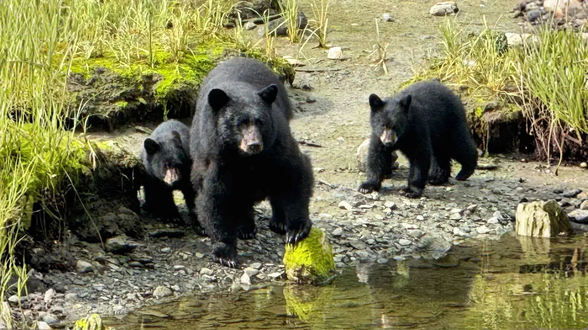 from $128.52
Free cancellation
from $128.52
Free cancellation Premium Rainforest Experience in Ketchikan
A van carries a small group, typically eight to ten people, into the Tongass National Forest to look for bears, eagles and salmon near waterfalls and spawning streams. Riders also get a digital port guide and texting support, useful for anyone new to Ketchikan.
Check Availability from $135
Small group
from $135
Small group Ketchikan Photo Safari
A local photographer guides small groups through Creek Street, Ketchikan Creek and Potlatch Totem Park, teaching composition and framing along the way. Suited to travelers who want photo coaching built into their sightseeing rather than a straight wildlife or cultural tour.
Check AvailabilityPrices, ratings and details are the platform's own. dollar figures are the listed prices — the platform bills in your account's currency.
What the Deer Mountain trail is
Deer Mountain is the big forested wall directly behind downtown Ketchikan, and the Deer Mountain National Recreation Trail is the path that climbs it. That is what separates this from every other entry on this site: it is not an attraction with a gate, a ticket or an operator. It is a Forest Service trail you start on foot from a residential street, and the only cost is your own legs.
The official numbers are blunt. The trail is 10.7 miles long overall, running all the way to Upper Silvis Lake. Within the first two miles it gains about 2,000 feet of elevation, which makes the opening stretch a sustained staircase-like grind rather than a warm-up. The tread is natural surface with boardwalk sections through muskeg near the start.
Two and a half miles up sits an A-frame shelter at 2,900 feet, a 16x16-foot structure rebuilt by the Forest Service in 2008-09 that sleeps up to eight and is free to use. Most day hikers turn around near the shelter or the open slopes above it, which is where the views over the Tongass Narrows open up.
One caveat belongs up front. The published elevation of the mountain does not agree with itself. The USFS trailhead page states a maximum elevation of 3,350 feet, while Wikidata and USGS GNIS give the summit as 3,001 feet. This guide does not resolve that conflict, it just tells you it exists.
For a structured day on the mountain without the full climb, Ketchikan Kayak Co. runs an e-bike and hike outing that pairs electric-assist cycling with a walk on foot, a four-hour option that suits cruise callers short on time.
What you see on the way up
You meet the trail in stages, and each stage looks different.
The walk in. From Ketchikan Lakes Road it is about 0.5 mile to the Nordstrom Drive junction, then a right turn into the trailhead parking area. You pass houses at first. The mountain is visible above you the whole way, which is useful because you can read the cloud layer before committing.
The lower forest. The trail starts in dense coastal rainforest. The surface is natural tread with boardwalk sections through muskeg near the start, so the first minutes alternate between soil and duckboard. Moss, devils club and standing water are the texture of this stretch. Expect to get your boots wet regardless of the forecast, because Ketchikan averages 149.54 inches of rain a year per the National Weather Service normals.
The climb. Roughly 2,000 feet of gain is packed into the first two miles. The path steepens into what amounts to a long, continuous ascent, with roots, rocks and occasional steps. There is no published list of switchbacks or viewpoint markers on the official page, so treat the route as one long uphill rather than a series of destinations.
The views. As you rise above the treeline zones, the view opens over the Tongass Narrows, the town below and the surrounding islands of the Tongass National Forest. On a clear day the reward is a full panorama of the waterways cruise ships thread through. On a fog day, which Ketchikan produces often, you may see cloud.
The shelter. At 2.5 miles and 2,900 feet sits the A-frame shelter, 16 by 16 feet, rebuilt by the Forest Service in 2008-09. It sleeps up to eight and is free to use first-come on the day. It is the natural turnaround for a day hike.
Beyond. Past Blue Lake the tread thins, and the Forest Service recommends hikers carry and know how to use a map, compass or GPS. The full 10.7-mile route to Upper Silvis Lake is a serious outing, not a cruise-day walk.
Hours, cost and what is not published
The Deer Mountain trail is open access in Tongass National Forest. The USFS trailhead page states no hours, and there is no gate to close. Hike it in daylight and you are within the only practical limit.
Cost: free. The Forest Service publishes no fee for the trail, and the A-frame shelter at 2,900 feet is also free to use. There is no reservation system stated for the shelter on the official USFS page. That makes this one of the few full-day activities near Ketchikan that costs nothing, against tours that routinely run $85 to $389 per person.
What is not published. The official page does not state a time needed for the hike, does not state trailhead hours, and lists no restrooms or potable water at the trailhead. A time estimate would be a guess, so this guide declines to make one. Plan your turnaround against your ship's all-aboard time, which appears in the City of Ketchikan's daily cruise schedule PDF rather than as a standalone rule.
Season. No official season dates are published for the trail itself. Ketchikan's visitor season runs roughly May through September, and the weather normals make the case for summer: June is the driest month at 7.02 inches of rain against October's 18.37 inches, and August is the warmest month at an average 59.0°F.
Price comparison with guided options. If you want structure instead of a self-guided climb, the E-Bike and Hike Tour from Ketchikan tours is $164 per person, rated 4.8 from 36 reviews, runs four hours, and requires riders to be at least 16. Its cancellation deadline is 7 days, far stricter than the 24 hours most Ketchikan tours allow, so book it only when your port day is certain.
Getting to the trailhead
The trailhead is unusual among Ketchikan attractions in that walking genuinely works.
On foot. From the downtown cruise berths, make your way to Ketchikan Lakes Road. The Forest Service directions are simple: go about 0.5 mile to the Nordstrom Drive junction, then turn right into the trailhead parking area. The total walk from a downtown berth is a warm-up, and it counts toward your day. No published distance from the berths exists on an official page, so budget by the map rather than a printed figure.
By bus. Ketchikan Gateway Borough Transit charges $2.00 per adult ride (ages 19-59), with youth and seniors at half that, and a $5.00 day pass if you want flexibility. Check whether a fixed route serves Ketchikan Lakes Road before relying on it. Inside downtown there is also a Free Downtown Shuttle Zone running roughly from Bryant Street to the Coast Guard Base through the summer season, which can shorten the walk to the start of your route.
By booked tour. You cannot book a shuttle to the trailhead as such, but Ketchikan Kayak Co. runs a four-hour e-bike and hike tour at $164 per person that removes the uphill approach problem entirely, rated 4.8 from 36 reviews.
What does not work. There is no parking-fee structure or shuttle described on the official USFS page, and no taxi or ride-share listing appears on any Borough page found during this check, so do not assume app-based rides exist in Ketchikan.
Before you leave town. There are no restrooms or potable water at the trailhead. Fill bottles and use facilities before you leave the waterfront.
One line from the official page, verbatim, because it is the kind of detail nobody else prints: No restrooms or potable water at the trailhead. Natural tread with boardwalk sections near the start; beyond Blue Lake the tread thins out and USFS recommends hikers be experienced with map, compass a
Deer Mountain map: the trailhead above the town
The trailhead is off Ketchikan Lakes Road at the Nordstrom Drive junction. The other pins are the nearest places on this site.
Do and don't on Deer Mountain
Practical rules for the day, drawn from what the official sources do and do not provide.
Do
- Fill water bottles in town, because the trailhead has no potable water.
- Check your ship's last departure in the daily schedule PDF before setting a turnaround time.
- Wear real rain gear, since June's 7.02 inches makes it the driest month of the year.
- Compare the free climb against the E-Bike and Hike Tour before committing your port day.
Don't
- Don't plan past Blue Lake without map and compass skills, per the USFS recommendation.
- Don't expect restrooms at the trailhead, there are none.
- Don't book the e-bike tour inside its 7-day cancellation window by accident.
- Don't rely on a ride-hailing app, since no official source confirms one operates in Ketchikan.
How long to give it
Three honest routings, sized to your day.
A short ship call. If you have four to five hours ashore and want mountain time, do not attempt the summit. Instead ride the E-Bike and Hike Tour, four hours at $164, minimum age 16, which pairs electric-assist cycling with a walk. It buys you forest and views on a fixed schedule. What it skips: the full 2,000-foot climb and the shelter. Note its 7-day cancellation deadline, the strictest among Ketchikan tours.
A full day in port. With six or more hours, walk to the trailhead via Ketchikan Lakes Road and Nordstrom Drive and climb toward the A-frame shelter at 2,900 feet, 2.5 miles up. The first two miles carry about 2,000 feet of gain, so the ascent is the whole outing. The shelter, free and sleeping eight, is the turnaround point for most day hikers. What this skips: Creek Street and the downtown totem stops, so save those for another call.
A second visit or a long independent stay. Hike past the shelter toward Blue Lake and beyond, where the tread thins and the Forest Service advises carrying and knowing how to use a map, compass or GPS. The full trail runs 10.7 miles to Upper Silvis Lake. This buys genuine wilderness and solitude and skips any chance of same-day downtown sightseeing.
Whatever the routing, work backward from your ship's last departure time, which the City publishes per ship in its daily schedule PDF. There is no standalone all-aboard rule on an official page, only that PDF. No official time estimate exists for the hike itself, so build in slack and turn around on the clock, not the summit.
Five things most visitors do not know
- The published summit elevation conflicts across sources. The USFS trailhead page says the trail reaches a maximum of 3,350 feet, while Wikidata and USGS GNIS list the summit at 3,001 feet, and no official page reconciles the two. (USFS / USGS GNIS via Wikidata) - The A-frame shelter at 2,900 feet is free to use with no reservation system stated on the official page.
It is a 16x16-foot structure rebuilt by the Forest Service in 2008-09 that sleeps up to eight. (USFS shelter site page) - There are no restrooms and no potable water at the trailhead, so everything you need has to come up from town with you. (USFS trailhead page) - The trail is 10.7 miles long in total, running all the way to Upper Silvis Lake, far beyond the turnaround most day hikers imagine.
(USFS trailhead page) - Beyond Blue Lake the tread thins out and the Forest Service recommends hikers be experienced with a map, compass or GPS. Past that point this is a backcountry route, not a town hike. (USFS trailhead page)
Next
Weather
What 149 inches a year does to a root-laced trail: Ketchikan weather.
Why the footing mattersDeer Mountain trail questions
How much does it cost to hike the Deer Mountain trail?
Nothing. The US Forest Service publishes no fee for the Deer Mountain National Recreation Trail or for the A-frame shelter at 2,900 feet, and no reservation system is stated for the shelter on the official page. That makes it the rare full-day Ketchikan activity that is free, against guided options like the $164 e-bike and hike tour. Compare the free climb with paid options on the tours page before you decide how to spend the day.
How high is Deer Mountain in Ketchikan?
The published figures disagree, and no official page reconciles them. The USFS trailhead page states the trail reaches a maximum elevation of 3,350 feet, while Wikidata and USGS GNIS give the summit as 3,001 feet. What both sources agree on is the climb itself: about 2,000 feet of gain within the first two miles. The A-frame shelter sits at 2,900 feet, 2.5 miles up the trail, which is the turnaround most day hikers use.
How do I get to the Deer Mountain trailhead from the cruise docks?
On foot. Walk to Ketchikan Lakes Road, continue about 0.5 mile to the Nordstrom Drive junction, then turn right into the trailhead parking area, per the USFS directions. No official page publishes the walking distance from the berths, so budget by the map. Borough Transit charges $2.00 per adult ride if you want to shorten part of the route, and downtown has a free shuttle zone from Bryant Street to the Coast Guard Base. See getting around for fares.
Is the Deer Mountain trail worth it on a cruise stop?
It depends on your hours ashore and your legs. The trail is free, starts within walking distance of town, and rewards the first two miles, which carry about 2,000 feet of gain, with views over the Tongass Narrows. But no official time estimate exists, and the trailhead has no water or restrooms. If your port day is short or the climb does not suit you, the E-Bike and Hike Tour at $164 over four hours delivers a fixed schedule instead.
What is the Deer Mountain trail like in rain?
Wet, and you should plan for it. Ketchikan's normal annual precipitation is 149.54 inches, and even the driest month, June, averages 7.02 inches. The trail surface is natural tread with boardwalk sections through muskeg near the start, so footing is slick and muddy after rain. Waterproof boots and rain layers are the baseline. For the regional climate picture, see the Ketchikan weather page, which prints the monthly normals behind those figures.
Who is the Deer Mountain trail suitable for?
Hikers comfortable with a sustained, steep climb on natural tread. The first two miles gain about 2,000 feet, and beyond Blue Lake the tread thins to the point that the Forest Service recommends experience with a map, compass or GPS. There is no water or restroom at the trailhead, and no official difficulty rating or time estimate is published. Families wanting an easier forest walk should look at the rainforest sanctuary instead, which runs guided walks on flat ground.
Deer Mountain on video
Three films that show this place at real pace, which is the check on every time figure above.
11 Amazing Things You MUST Do in Ketchikan, Alaska
Includes the trailhead and the first stretch of climb.
Video: Art We There Yet?Best Things to Do in Ketchikan Alaska Travel Guide
Covers the hillside above the town.
Video: Destination AwaitsWhat to Do in Ketchikan Alaska on a Cruise Port Day
Shows how far the trailhead is from the berths.
Video: Take2TravelLinked as published on YouTube. We have no connection to these channels.
We may earn a commission if you book through one of our links, at no extra cost to you. Full affiliate disclosure