 Ketchikan City Guide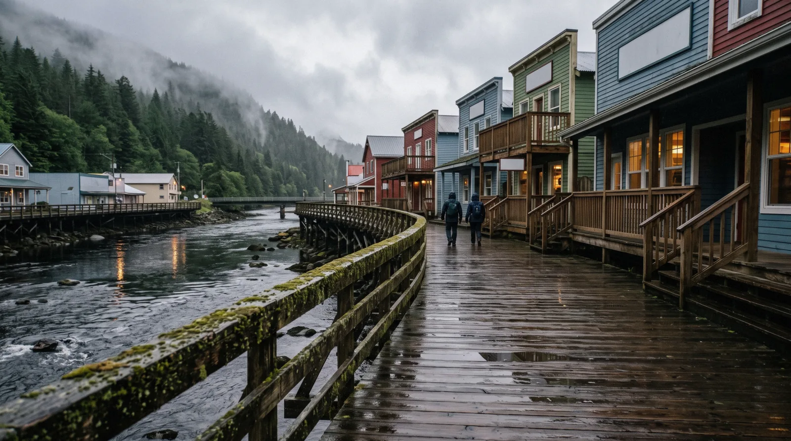
Ketchikan Map
This Ketchikan map carries 23 points: every place in the guide except the forest itself, plus the berths, the ferry terminals and the Welcome Center, coloured by what it costs rather than by what it is. Green is free, cedar red is a totem site, ink is a paid door or one that will not say its price, and amber sits off the road system entirely and needs a boat or a plane. Coordinates come from Wikidata or OpenStreetMap and the two that no registry lists are marked on the pin. The whole guide starts on the Ketchikan city guide homepage, and things to do in Ketchikan ranks the same list in text.
Quick answer What is walkable from the berths, and what needs a boat
Six of the places on this map sit within a few minutes of the downtown berths, and five of those cost nothing: Creek Street, Married Man's Trail, the Deer Mountain trailhead, and the boardwalk either side of them. The Discovery Center is $5 and indoors. Everything on the north and south roads needs the $2.00 bus or a tour, and the four amber pins need a boat or a floatplane. Only three places on the whole map publish a price.
Key takeaways
- Green pins cost nothing, and there are five of them inside the town: start with Creek Street.
- Cedar pins are the four totem sites, and only Totem Bight publishes a fee.
- Ink pins are paid doors, including three that never state a price: see what Ketchikan costs.
- Amber pins are off the road system, so each one is a booked boat or flight.
The map
Numbered pins, filterable by what they cost, plus the arrival and transport points a first visit actually needs. The list below the map is the same set in text, grouped the same way, and every place links to its own page. Coordinates are Wikidata P625 or OpenStreetMap: where neither publishes one, the pin sits on the nearest street and says so. The Tongass National Forest carries no pin: at roughly 16.7 million acres it is the ground the whole map sits on, and a single dot in the middle of it would say nothing. The grey pins are infrastructure rather than sights: the berths, the two ferry terminals, the Welcome Center and the library. Their coordinates come from OpenStreetMap address lookups against the addresses the city, the borough and the state publish.
Free 4 pins
- Creek StreetFreeCheck AvailabilityThe boardwalk on pilings over Ketchikan Creek, built as the red-light district and listed on the National Register in 2014. A public street with no gate, so it costs nothing at any hour.
- Deer Mountain trailheadFreeCheck AvailabilityThe Forest Service trail out of town, 10.7 miles to Upper Silvis Lake with about 2,000 feet of climb in the first two miles. Free, and no booking exists.
- Herring CoveFreeCheck AvailabilityWhere the south road ends, and where every wildlife tour turns around. Free to stop at.
- Married Man's TrailFreeCheck AvailabilityThe stair and plank route climbing beside the creek from the boardwalk to the museum on the hill. No city or Forest Service page describes it at all.
Totem sites 4 pins
- Potlatch Totem ParkFrom $85 with a tourCheck AvailabilityA privately owned pole park and working carving centre a mile north of Totem Bight, built around a 42-foot Raven pole.
- Saxman Native VillageFrom $84 with a tourCheck AvailabilityA Tlingit village on the south road holding the largest standing collection of totem poles anywhere. Visited guided, through Cape Fox Tours.
- Totem Bight State Historical Park$5Check AvailabilityClan house and standing pole group at milepost 10 on the north road, rebuilt from 1938 by Tlingit and Haida carvers under a Forest Service and CCC program.
- Totem Heritage CenterFrom $84 with a tourCheck AvailabilityOriginal nineteenth-century poles recovered from abandoned village sites and kept indoors unrestored, at 601 Deermount Street.
Paid, or price unpublished 4 pins
- Alaska Rainforest Sanctuary$99 directCheck AvailabilityA 40-acre private preserve at Herring Cove with a boardwalk through old growth, 17 original Alaska Native poles and a 40-foot pole.
- Dolly's House MuseumFrom $135 with a tourCheck AvailabilityThe preserved house of Dolly Arthur, who bought 24 Creek Street in 1919 and stayed after the houses closed in the early 1950s. The one paid door on the boardwalk.
- Great Alaskan Lumberjack ShowFrom $157.94 with a tourCheck AvailabilityA covered arena of timber sports beside the berths, with a second venue on the Ward Cove pier. Shows run about an hour, several times a day.
- Southeast Alaska Discovery Center$5Check AvailabilityThe Forest Service visitor centre at 50 Main Street: four exhibit halls, a 200-seat theatre named for Elizabeth Peratrovich, and a live underwater camera on the spawning salmon.
Off the road system 3 pins
- George InletFree waterCheck AvailabilityPublic water inside the Tongass, named in 1880 by the US Coast and Geodetic Survey after Captain W.E. George. The lodge on it sells the crab lunch.
- Misty Fjords National MonumentNo entrance feeCheck Availability2,142,243 acres of granite and rain up Behm Canal, the largest wilderness on the Tongass. Reachable only by boat or floatplane.
- Neets BayNo self-visit priceCheck AvailabilityA hatchery on Behm Canal releasing about 62 million summer chum eggs a year, which is why the bears are there. Roughly 30 to 35 air miles out, with no road.
Arrival and transport 8 pins
- Airport ferry, town side$6.00 adult4171 Tongass Avenue. Leaves the town side on the quarter hours, 6:15am to 9:30pm, with a second boat on summer weekdays.
- Alaska Marine Highway terminalQuoted per sailing3501 Tongass Avenue, about 2 miles from downtown and next to the airport ferry. Bellingham to Ketchikan is about 38 hours.
- Downtown cruise berths I to IVFreeThe four Panamax berths, numbered I to IV south to north along the waterfront. Everything in the town core is walkable from all four.
- Ketchikan International Airport$6.00 ferryOn Gravina Island, with no bridge. Every arrival and departure crosses on the borough ferry.
- Ketchikan Public LibraryFree1110 Copper Ridge Lane, above the town with a view to Deer Mountain. Free WiFi and public computers, open seven days.
- Ketchikan Visitors Bureau Welcome CenterFree131 Front Street, beside the cruise dock. Monday to Friday 8:00am to 5:00pm, on (907) 225-6166.
- Tongass Historical MuseumAsk at the door629 Dock Street, run by the City of Ketchikan. The city page gives the address and the phone but not the admission.
- Ward Cove cruise dockFree shuttleA converted pulp mill seven miles north, two berths on a floating pier. The free shuttle to Berth IV runs about 20 minutes each way.
Coordinates come from each place's own published point: the entity pins from a verified Wikidata item or an OpenStreetMap record, and the grey arrival pins from an OpenStreetMap lookup against the address the city, the borough or the state publishes. Two places are in neither registry, Dolly's House and Married Man's Trail, so their pins sit on the Creek Street boardwalk and say so. Where a price column is empty the venue publishes none, and the page for that pin explains what to do instead.
The five pins worth building a day around
Twenty-three points sit on the map above and most visitors get four or five hours. These are the five we would spend them on, in order, with the reason rather than a ranking. Two of the five cost nothing and two cost $5.
| Place | What it costs | Why this one |
|---|---|---|
| Misty Fjords National Monument | $389 by floatplane | Nothing else here is unlike anywhere else. Two million acres of granite walls dropping into black water, and the Forest Service charges nothing to enter it, so the whole price is the aircraft. Two hours in the air out of an eight-hour call, and it is the one booking worth making before you sail. |
| Creek Street | Free | The best free thing in town and the one most people see badly, because they arrive with four other ships. Walk it in the first hour ashore or after the last coach has gone, and in late July and August watch the salmon under the planks from the bridges. |
| Totem Bight State Historical Park | $5 | The only totem site around Ketchikan you can plan a budget against. A clan house and a stand of poles rebuilt from 1938 by Tlingit and Haida carvers, at milepost 10, reachable on the $2.00 bus with free parking if you drive. |
| Southeast Alaska Discovery Center | $5, free in winter | It rains 232.6 days a year here, and this is the answer. Four halls on the Tongass, a theatre and a live underwater camera on the spawning creek, minutes from the berths, free for children 15 and under with an adult. |
| Neets Bay bear viewing | $399 | The honest bear trip. A working hatchery stream 30 air miles out with viewing platforms above it, which is a far better chance than a roadside stop, and the only one on this map where the odds are the fish rather than luck. |
Figures current for Q3 2026.
Reaching the pins you cannot walk to
Four trips covering the amber pins and the far ends of both roads. Prices, ratings and durations are the platform’s own figures.
 from $389
Small group
from $389
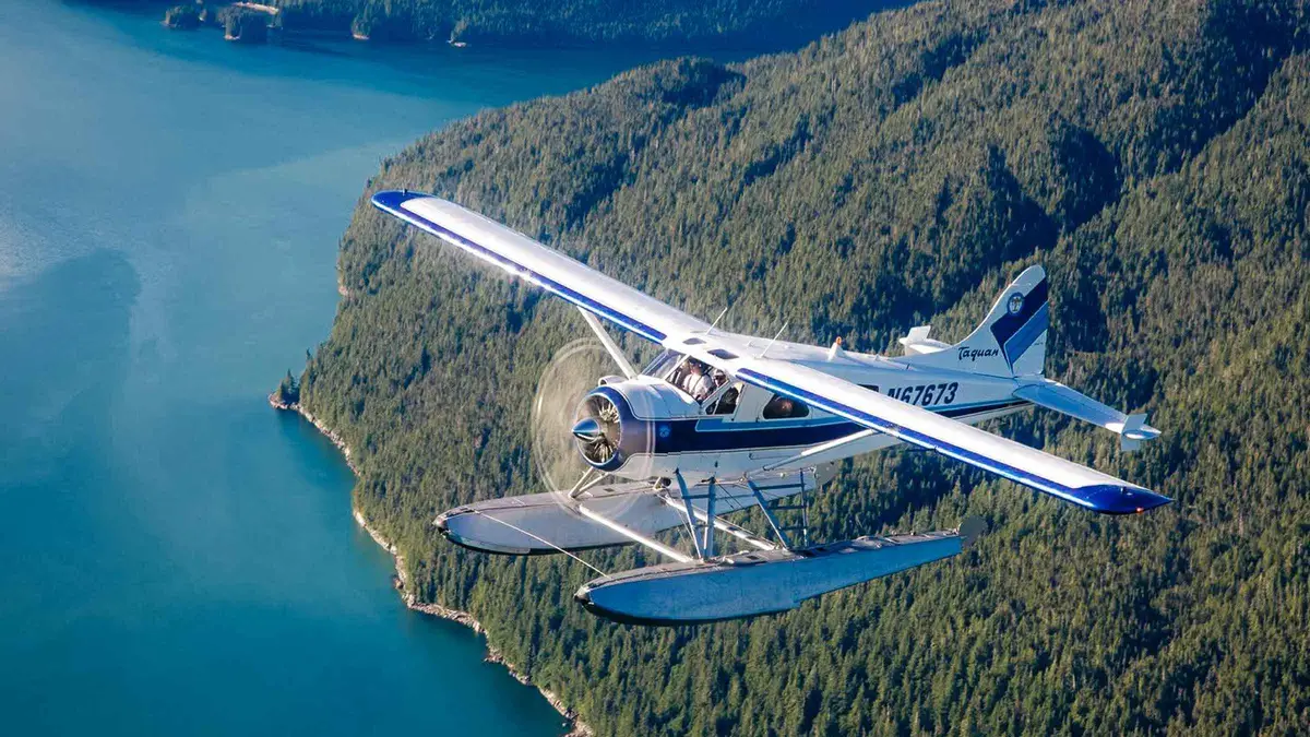
Small group Ketchikan: Misty Fjords National Monument Floatplane Tour
A six-passenger floatplane lifts off from Ketchikan for a low flight over Misty Fjords National Monument, with the pilot narrating the route by headset. Good for travelers who want an aerial view of the fjords and forest without a long day on the water.
Check Availability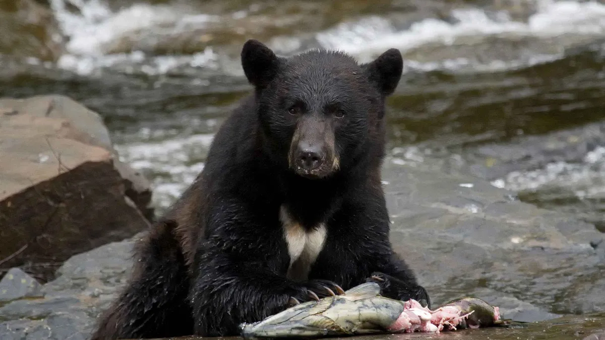 from $399
Free cancellation
from $399
Free cancellation Ketchikan: Neets Bay Black Bear Viewing Tour with a Cruise
A van and speedboat combination carries small groups to Neets Bay, where forest trails lead to platforms overlooking a salmon stream favored by black bears. Suited to visitors comfortable with a five-hour outing that mixes a boat ride with walking on uneven trails.
Check Availability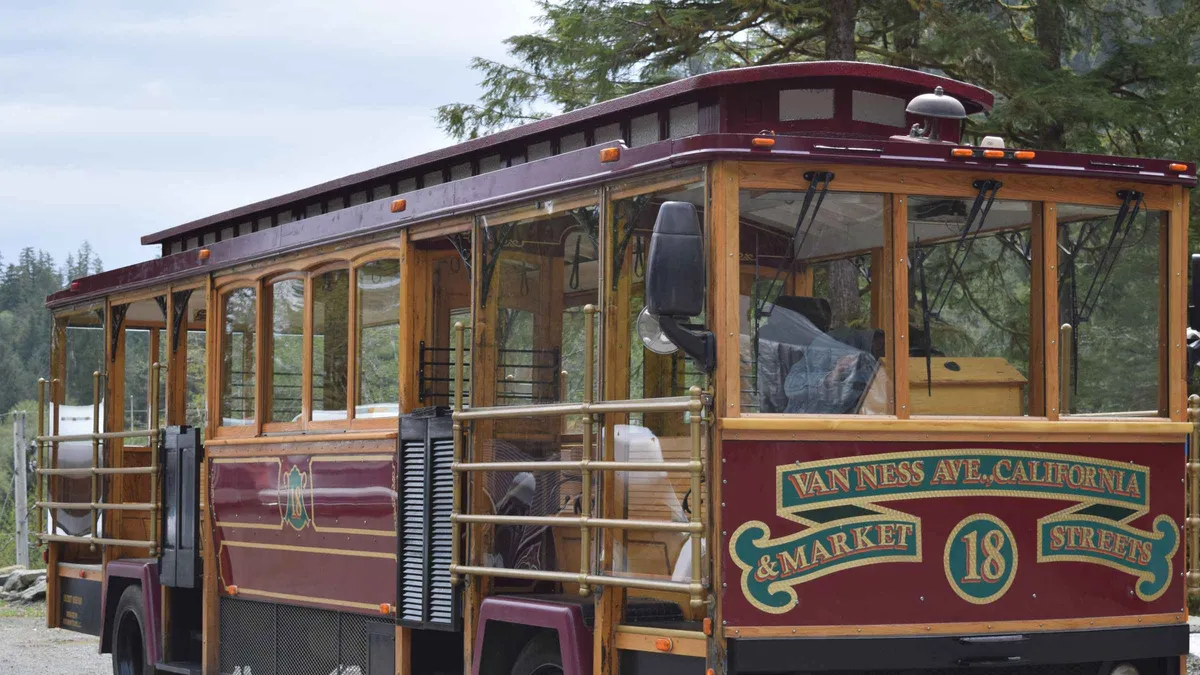 from $85
Free cancellation
from $85
Free cancellation Ketchikan: Totem Pole, Wildlife & City Trolley Tour
An open-sided San Francisco style trolley tours Saxman Native Village's carved totem poles and carving shed, then continues to Herring Cove for a chance at eagles, seals and bears. A shorter option for travelers who mainly want the totem poles and a quick wildlife stop.
Check Availability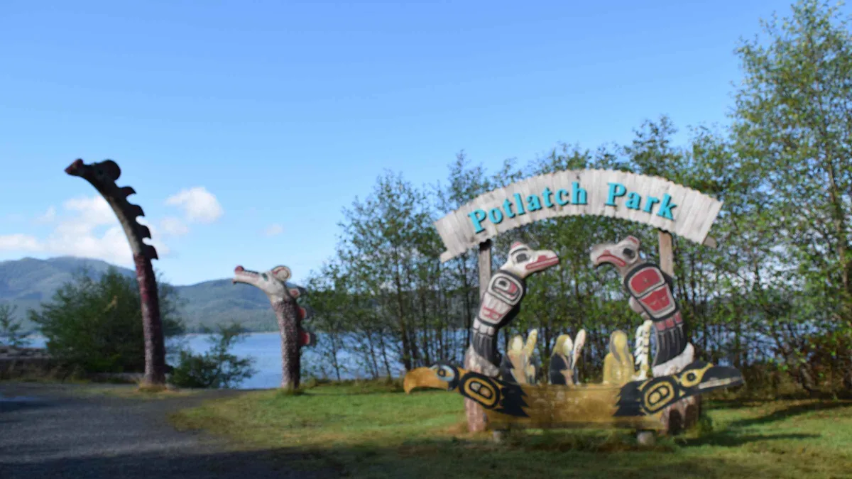 from $85
Free cancellation
from $85
Free cancellation From Ketchikan: Potlatch Totem Park and Herring Cove Tour
This van tour combines a Potlatch Park visit, with its totem carving center and antique firearms display, with time at Herring Cove watching for bears, eagles and seals. A middle-ground pick for those wanting both carving history and a wildlife stop in one trip.
Check AvailabilityPrices, ratings and details are the platform's own. dollar figures are the listed prices — the platform bills in your account's currency.
What the five colours mean
The map is coloured by what a place costs you, not by what kind of place it is, because cost is the thing that decides a four-hour call and category is not.
Green is free. Five pins, and between them they carry most of what people remember about Ketchikan: the Creek Street boardwalk, the Married Man's Trail stairs behind it, the Deer Mountain trailhead above the town, and Herring Cove at the end of the south road. Nothing on a green pin has a gate, an opening hour or a ticket.
Cedar red is the totem sites. Four pins, and exactly one of them publishes a price: Totem Bight at $5. Saxman leaves the self-guided fee to the City of Saxman, which states it nowhere. Potlatch Totem Park says on its own site that an entry fee supports the park and never names it. The Totem Heritage Center publishes its hours but not its admission. The colour groups them because the choice between them is a single decision, laid out on the totem poles page.
Ink is a paid door, or one that will not say its price. The Discovery Center at $5, the Alaska Rainforest Sanctuary at $99 direct, Dolly's House, which has no website at all, and the Lumberjack Show, which sends you into a checkout before naming a figure.
Amber is off the road system. Misty Fjords, Neets Bay and George Inlet beyond the lodge road. Each one is a boat or an aircraft, and the price on the pin is the transport rather than the place.
Grey is arrival and transport. The berths, both ferry terminals, the airport, the Welcome Center and the library. These are not sights and we do not pretend they are, but they are what a first hour ashore actually needs.
Why the map looks lopsided
Ketchikan sits on the western shore of Revillagigedo Island, on a strip between the water and a steep wooded ridge, and the road runs along that strip rather than through a town centre. That is why the pins form a line rather than a cluster, and why the distances on this map mislead if you read them as a European city.
There is no road out. The system runs a short way north and a short way south and then stops, and no official source publishes its total length. The airport is not on this island at all: it sits across the Tongass Narrows on Gravina Island, with no bridge, which is why the grey pin for it sits on the far shore and the pin beside it is a ferry landing.
Two consequences for a day. Anything on a green or ink pin in the town core is within a few minutes on foot of the berths, so the walking half of this map is genuinely walkable. Everything cedar-red is a bus ride at $2.00 or a tour, because the totem sites sit at the two ends of that strip: Totem Bight at milepost 10 north, Saxman south. And everything amber leaves the island.
The four pins no road reaches
Four points on this map are not reachable by car at any price, and they are the four most people come for.
Misty Fjords National Monument is up Behm Canal, east of town. The Forest Service charges no entrance fee for it, so the whole cost is the aircraft or the boat: the floatplane is $389 for about two hours. It cancels for cloud rather than for rain, which on a wet coast is a useful distinction.
Neets Bay is a working hatchery roughly 30 to 35 air miles out, releasing about 62 million summer chum eggs a year, which is the reason bears are there at all. The trip that goes is $399 and takes five hours door to door.
George Inlet has a road to the lodge on it but the inlet itself is public water inside the Tongass, and the crab lunch at $109.95 is what almost everybody is actually buying.
Prince of Wales Island and Metlakatla carry no pin here at all, because neither is a day trip from a ship call and putting them on the same map as a boardwalk would imply they are.
The gaps on this map, and why each one is a finding
Four things are missing from the map above on purpose, and each absence is information rather than an oversight.
- Two places have no coordinate anywhere. Neither Dolly's House nor Married Man's Trail appears in Wikidata or OpenStreetMap, so their pins sit on the Creek Street boardwalk and the pin says so. We would rather show you the street than place a dot by eye. - The forest has no pin. The Tongass runs to roughly 16.7 million acres and every other pin on this map sits inside it. A dot in the middle of that tells a reader nothing, and earlier drafts of this page had one that dragged the whole view 200 kilometres north. - Three price columns are empty. Not because we did not look, but because the venue publishes nothing. The page for each one says what we checked and what to do instead. - Herring Cove carries no wildlife claim. Every operator that drives past it describes bears and eagles there. No Alaska Department of Fish and Game or Forest Service page documents the cove by name as a viewing site, so this map marks it free and says nothing more.
From October the map changes colour
Half of what this map shows is seasonal, and the change happens on two specific dates rather than gradually.
On 1 October the sales tax drops from 8% to 5.5%, and the Discovery Center stops charging its $5 altogether and becomes free until April. So the ink pin that is the best value in summer becomes the best value in winter by a wider margin.
The cruise season runs roughly May to September, so from October the amber pins largely stop being sold: flightseeing and the bear trips run on the visitor season, and the hatchery run that makes Neets Bay worth the money is over by then anyway.
What does not change is the green. Creek Street is a public street with no gate at any time of year, Totem Bight keeps 7:00am to 6:00pm all year, and the Deer Mountain trailhead has no season at all. What limits them in winter is daylight: 7 hours 5 minutes at the December solstice against 17 hours 27 minutes in June. Ketchikan weather has the month-by-month picture.
Next
Things to do
The same places ranked in text, with the times to allow: things to do in Ketchikan.
The list version of this mapThe cruise port
Which of the grey pins your ship uses, and what that costs you: how the Ketchikan cruise port works.
Where the day startsKetchikan map questions
What is within walking distance of the cruise berths?
Creek Street, Dolly's House, the Married Man's Trail stairs, the Totem Heritage Center up the hill and the Southeast Alaska Discovery Center. Five of those six are free or have no published price, and the Discovery Center is $5 in season. The Port of Ketchikan publishes no walking time from the berths, so the minutes on things to do in Ketchikan are ours, read off the map rather than off an official page.
Is there an official Ketchikan cruise port map?
The City of Ketchikan publishes a daily cruise schedule with passenger capacities rather than a visitor map, and the berth layout is described on its port page as four berths numbered I to IV, south to north. That is the layout the pins above follow. How the Ketchikan cruise port works covers which berth does what, and Ward Cove covers the dock seven miles north.
Why do some pins say no price is published?
Because none is. Of the sixteen places on this map only Totem Bight at $5, the Discovery Center at $5 and the Alaska Rainforest Sanctuary at $99 state a figure on an official or operator page. The Lumberjack Show, Potlatch Totem Park, Saxman and Dolly's House do not, and we print that rather than a reseller's guess.
Which places need a boat or a plane?
Misty Fjords, Neets Bay, George Inlet beyond the lodge road, and anything on Prince of Wales Island or at Metlakatla. Ketchikan's road system runs a short way north and a short way south and connects to nothing, and no official source publishes its total length. Getting around Ketchikan covers what the road does reach.
How accurate are these coordinates?
Fourteen of the sixteen come from Wikidata's own coordinate property or from OpenStreetMap, and each entity page names which. Two have no entry in either registry, Dolly's House and Married Man's Trail, so their pins sit on the Creek Street boardwalk and say so on the pin rather than being placed by eye.
Can I use this map offline?
The map needs a connection to draw its tiles, so save the list rather than the map. The practical version is the ranked text list on things to do in Ketchikan, which carries the same sixteen places with the same prices, and Ketchikan without a tour, which puts the walkable ones in order with the times to allow.
The map on video
Three films that walk the distances this map flattens, which is the fastest way to judge whether a pin is really five minutes away.
What to Do in Ketchikan Alaska on a Cruise Port Day
The green and ink pins at walking pace from the berths.
Video: Take2TravelBest Things to Do in Ketchikan Alaska Travel Guide
Covers the cedar pins at both ends of the road.
Video: Destination Awaits11 Amazing Things You MUST Do in Ketchikan, Alaska
Includes an amber pin, filmed from the aircraft.
Video: Art We There Yet?Linked as published on YouTube. We have no connection to these channels.
We may earn a commission if you book through one of our links, at no extra cost to you. Full affiliate disclosure