 Ketchikan City Guide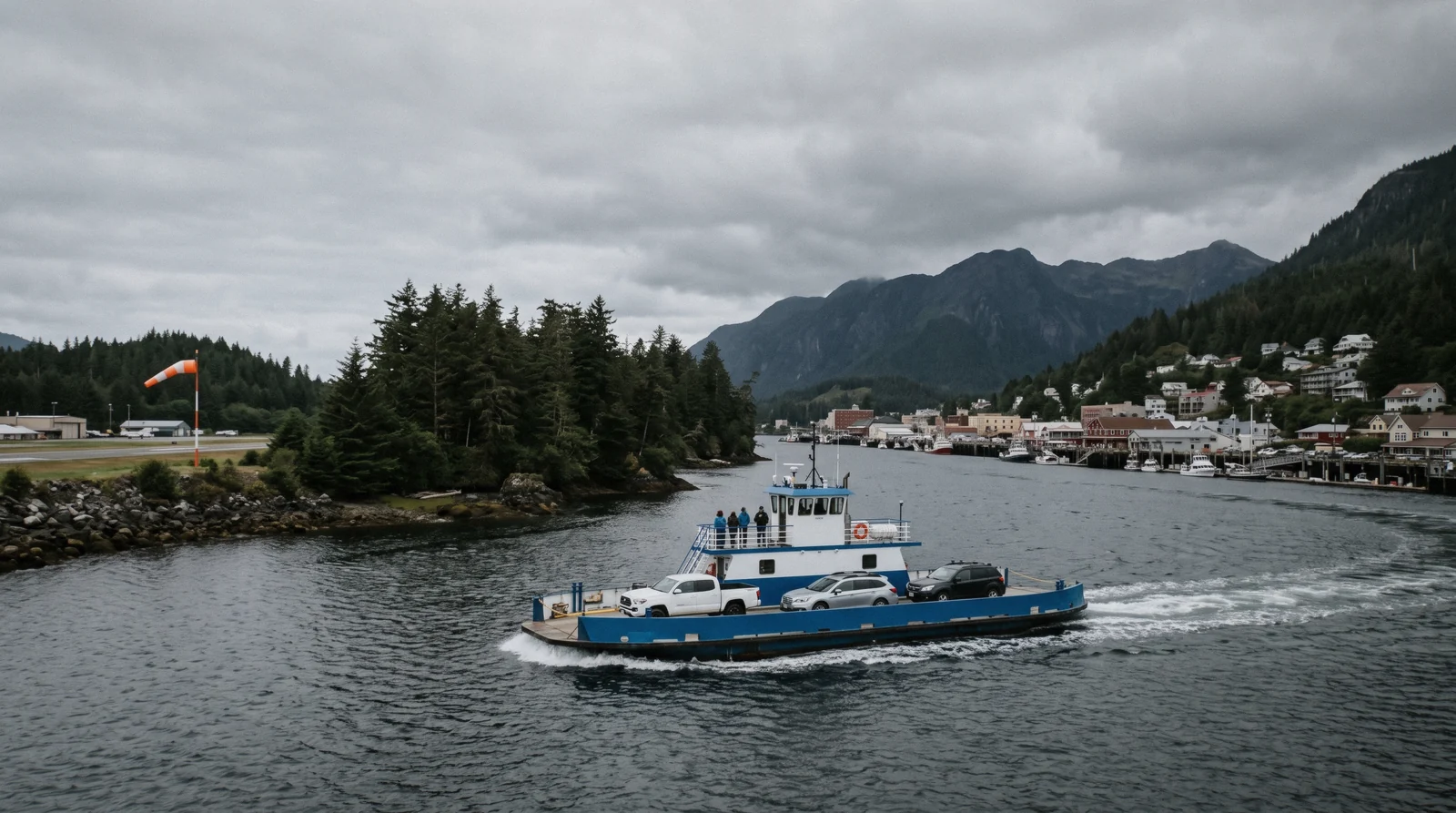
How to Get to Ketchikan, Alaska
There are three answers to how to get to Ketchikan Alaska and none of them is a road. how to get to Ketchikan is the first puzzle every visitor faces. The town sits on Revillagigedo Island in Southeast Alaska, and no road connects it to anywhere else. That leaves three ways in: by cruise ship, by plane into Ketchikan International Airport, or aboard an Alaska Marine Highway state ferry. Even the airport sits on a separate island, reached by its own short ferry. This page covers each route, the fares and schedules that official sources publish, and the gaps they leave. For what to do once you land, start with things to do. The town all of this sits in is the Ketchikan guide you are travelling to.
Quick answer Three ways in, no road connection, airport on its own island
There is no road into Ketchikan, so you arrive by cruise ship, by plane, or on an Alaska Marine Highway ferry. Most visitors come by ship and dock downtown or at Ward Cove. Flyers land at Ketchikan International Airport on Gravina Island and cross by borough ferry, $6.00 one way per adult and $7.00 per standard vehicle, running daily from 6:15am to 9:30pm. Alaska Airlines is the scheduled jet carrier, with daily service linking Ketchikan to Seattle, Anchorage, Juneau, Sitka, Petersburg and Wrangell. The state ferry terminal sits at 3501 Tongass Avenue, about 2 miles from downtown, and fares are quoted per sailing rather than published flat. Compare arrival days with the best time to visit and budget using Ketchikan costs.
Key takeaways
- Cruise passengers dock at four downtown berths or at Ward Cove, about 7 miles north, and the cruise port page covers both in detail.
- The airport ferry charges $6.00 per adult and $7.00 per standard vehicle each way and runs from 6:15am to 9:30pm daily.
- Alaska Airlines offers daily jet service to Seattle and Anchorage plus Juneau, Sitka, Petersburg and Wrangell.
- State ferry fares must be looked up per sailing through the Alaska Marine Highway fare tool because no flat fare is published.
No road in
Ketchikan sits on Revillagigedo Island in Southeast Alaska, and the local road system connects to nothing. There is no highway link to the rest of Alaska, to Canada, or to the lower 48. The Ketchikan Gateway Borough does not publish the total mileage of the local road network on its Roads page or on any other official page found for this guide, so no figure is printed here.
That fact shapes every arrival. You reach Ketchikan one of three ways.
- By cruise ship. The majority of visitors arrive this way during the season. Ships dock at four downtown berths or at Ward Cove, roughly 7 miles north. See the cruise port guide for berths, the Ward Cove shuttle and daily schedules. - By air. Scheduled jets land at Ketchikan International Airport, and floatplanes serve the smaller communities. The airport sits on Gravina Island, a short ferry ride from town. - By state ferry. The Alaska Marine Highway System connects Ketchikan with other Southeast ports year round, including Prince of Wales Island (day trip ideas) and Metlakatla (community guide).
Who each suits is simple. Cruise passengers trade flexibility for ease, because the ship handles transport, meals and a fixed schedule. Flyers get the most control over their dates and can stay as long as they like. Ferry riders split the difference, moving under their own schedule between ports no road can reach. However you arrive, you will want the getting around page once you are in town.
The three ways into Ketchikan
There is no road. The fares below are the borough’s and the state’s own published figures, and where a system publishes no flat fare the column says so rather than guessing one.
| How you arrive | Published fare | Gets you to | The catch |
|---|---|---|---|
| Cruise ship | Inside your fare | A downtown berth or Ward Cove | You get the hours the ship gives you |
| Alaska Airlines jet | Not published here | Gravina Island, across the water | The airport is not in town. The ferry is $6.00 an adult, $7.00 a vehicle |
| Alaska Marine Highway | Quoted per sailing | 3501 Tongass Avenue, about 2 miles out | Bellingham to Ketchikan is about 38 hours, and no flat fare is published |
Figures current for Q3 2026.
The airport ferry
Ketchikan International Airport sits on Gravina Island. There is no bridge. Every passenger and every vehicle crosses the Tongass Narrows on a ferry operated by the Ketchikan Gateway Borough.
The fares are straightforward. One way costs $6.00 for adult passengers aged 12 and up, and $7.00 for a standard vehicle. Fares are charged each way, so a round trip costs double.
The departure pattern is easy to remember. From the Ketchikan side, at 4171 Tongass Ave, the ferry departs on the quarter hours. From the airport side, it departs on the hour and the half hour. The ferry runs daily from 6:15am to 9:30pm.
In the peak season there is more capacity. A second ferry adds 15-minute service on weekdays from 9:30am to 5:30pm, in operation from May 18 through September 18.
What this means in practice:
- With luggage. You wheel or carry your bags onto the boat, ride about five minutes across the narrows, and roll off on the other side. There is no check-in or security on the crossing itself. - With a tight flight connection. Work backwards from the ferry schedule, not just your flight time. Missing a quarter-hour departure on the Ketchikan side can cost you 30 minutes or more if the boat has just left. The summer weekday boat halves that risk within its hours. - With a rental car. Vehicles queue for the same boat. The $7.00 vehicle fare is on top of the passenger fare for anyone riding in the car.
Once you are on the town side, the airport ferry dock on Tongass Ave puts you close to the Borough Transit route, where a single adult ride costs $2.00 and a digital day pass costs $5.00. Taxis meet most flights, though no official municipal page lists taxi companies or confirms ride-share coverage, so check your app before relying on it. The getting around page covers local transport in full.
One consequence worth planning around. The ferry runs 6:15am to 9:30pm, so a flight before about 7:30am means either a very early crossing or a bed on the airport side of town. That is the single case where sleeping out of the centre beats sleeping downtown, and it is worth checking before you book the flight rather than after.
Flying to Ketchikan
Alaska Airlines is the scheduled jet carrier serving Ketchikan International Airport. It provides daily jet service between Ketchikan and Seattle, plus daily service to and from Anchorage, Juneau, Sitka, Petersburg and Wrangell.
One honest caveat. The official Alaska Airlines airport information page for Ketchikan did not render specific route and frequency detail when the source data for this guide was collected. That means any exact departure counts you read elsewhere, including here, are secondary figures. Check the airline's own booking tool for the schedule that applies to your dates.
Beyond the jets, floatplanes act as scheduled transport to the smaller communities that no road and no jetway reach. Operators in Southeast fly under FAA Part 135 air taxi certificates, the same category used for the Misty Fjords flightseeing routes. If your destination is a village off the main system, a floatplane or small charter may be the only scheduled option.
A few practical points:
- Seattle is the main lower-48 gateway, with Anchorage and Juneau as the key in-state connections. - Winter weather, including heavy fog days concentrated from October through January, can affect small-aircraft schedules more than jet schedules. - The airport itself is covered above, including the $6.00 adult ferry fare and the 6:15am to 9:30pm operating window.
If you are flying in for a short stay, the one day in Ketchikan and two days in Ketchikan itineraries show what fits. For longer trips, the plan page pulls the pieces together.
The state ferry
The question people actually ask is whether there is a ferry from Seattle. There is not. The Alaska Marine Highway's southern terminus in the lower 48 is Bellingham, Washington, about 90 miles north of Seattle, and Ketchikan is the first Alaskan port of call from there, a sailing of about 38 hours. If you have read Seattle somewhere, that is the error.
The Alaska Marine Highway System is the state ferry network that keeps Ketchikan connected to the rest of coastal Alaska. It is the only way to bring a vehicle to or from town without flying it in on a barge.
Ketchikan's ferry terminal sits at 3501 Tongass Avenue, about 2 miles north-west of downtown and a short way along the road from the airport ferry landing. The terminal there is a purpose-built $10 million building, not a dock with a shed on it. It is not walkable from downtown, so budget time and transport for the trip out to it.
Here is the important honest point. The Alaska Marine Highway System does not publish flat fares. Every fare is quoted per sailing, and it varies by route, by season, by passenger age and by vehicle size. There is no single number this page can truthfully print for a crossing.
What to do about that:
- Use the AMHS Sailing Search and fare tool at dot.alaska.gov/amhs to price your exact sailing, with your dates and vehicle class. - Book early for summer sailings, when demand across Southeast peaks. - If you are vehicle-free, remember the terminal is at 3501 Tongass Avenue, not downtown, and plan the transfer.
The ferry is also how locals and independent travelers reach nearby communities. Prince of Wales Island is a common crossing for fishing, caving and quiet beaches, covered in the Prince of Wales Island guide. Metlakatla, on Annette Island, is the other frequent run, described in the Metlakatla guide. For an overnight base near the ferry side of town, see where to stay.
Arriving by ship
Most visitors arrive on a cruise ship, so here is the short version. Ketchikan's downtown waterfront has four Panamax-sized berths, numbered I through IV from south to north, each with an adjacent float. Ships too large or too numerous for those berths use Ward Cove, about 7 miles north of downtown, where a complimentary shuttle runs continuously to Berth IV and takes about 20 minutes each way.
That is the summary. The cruise port guide owns this subject in full, with berth details, the daily schedule PDF published by the city, and walking times into town. If your ship docks at Ward Cove rather than downtown, read the Ward Cove guide separately, because the arrival experience there differs in useful ways, from the shuttle rhythm to what is on site.
Cruise arrival also changes how you plan everything else. Your time in port is set by the ship's schedule, tours book around the berths, and rainy-day logistics matter more when you cannot simply stay another day. The shore excursions catalogue lists bookable options, and ketchikan without a tour shows what you can do on foot from the pier.
Trips that use the same water and air you arrived on
Four excursions that put you back on a floatplane or a boat, which is how everything here moves. Prices, ratings and durations are the platform’s own figures.
 from $389
Small group
from $389
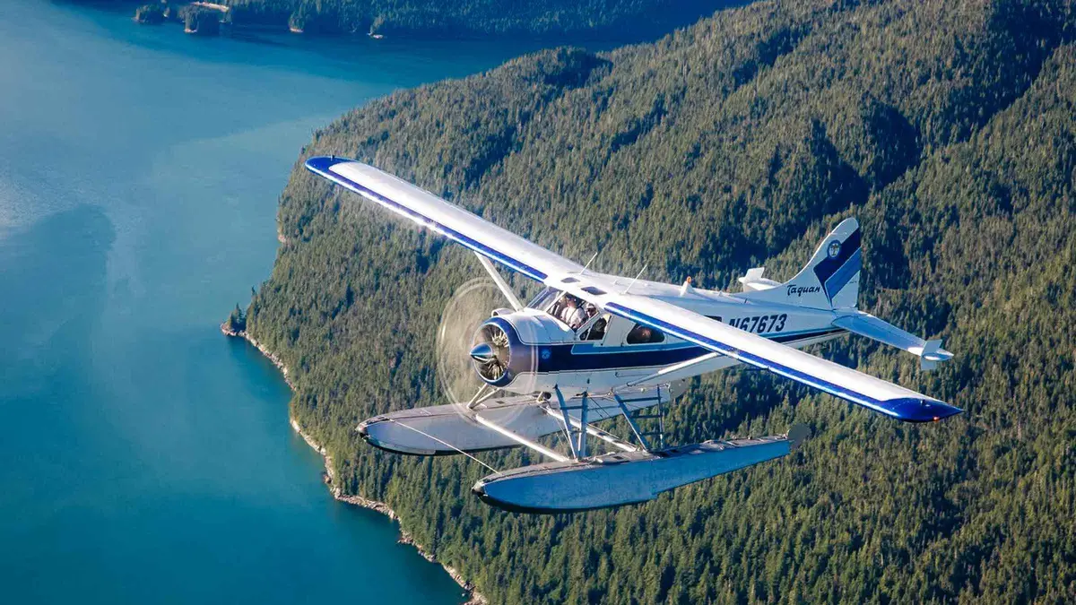
Small group Ketchikan: Misty Fjords National Monument Floatplane Tour
A six-passenger floatplane lifts off from Ketchikan for a low flight over Misty Fjords National Monument, with the pilot narrating the route by headset. Good for travelers who want an aerial view of the fjords and forest without a long day on the water.
Check Availability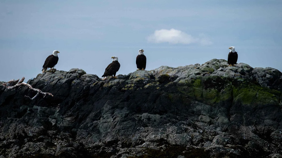 from $124
Pickup available
from $124
Pickup available Ketchikan: Lighthouse, Totems & Eagles Excursion
A heated tour boat departs Ward Cove for a wildlife cruise past Totem Bight State Park and the century-old Guard Island Lighthouse, with binoculars and a snack plate provided. A good fit for guests who want reliable eagle sightings from the water, not on foot.
Check Availability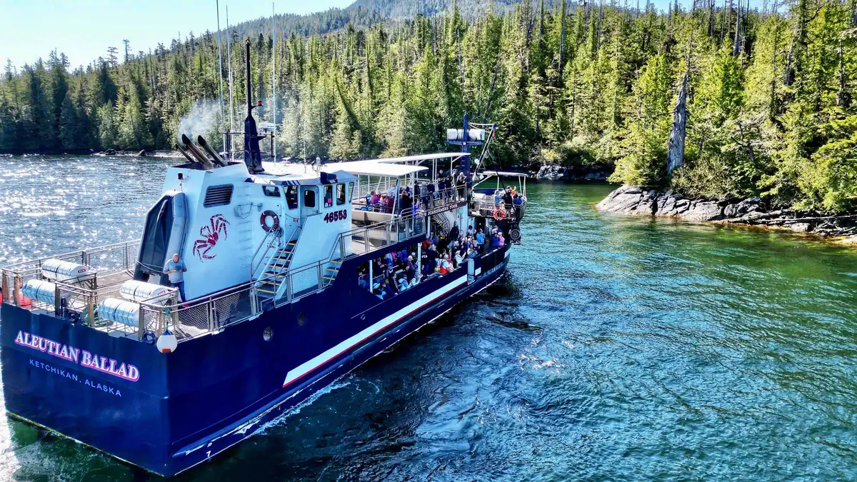 from $249
Free cancellation
from $249
Free cancellation Bering Sea Crab Fishermen's Tour
Retired Bering Sea crab boat captains run this three-hour cruise past Annette Bay, pulling crab and prawn pots while eagles dive for scraps off the water. A calm-water option for families who want a working boat story told by the people who lived it.
Check Availability from $135
Small group
from $135
Small group Ketchikan Photo Safari
A local photographer guides small groups through Creek Street, Ketchikan Creek and Potlatch Totem Park, teaching composition and framing along the way. Suited to travelers who want photo coaching built into their sightseeing rather than a straight wildlife or cultural tour.
Check AvailabilityPrices, ratings and details are the platform's own. dollar figures are the listed prices — the platform bills in your account's currency.
Next
Getting around
The bus, the free downtown zone and what the road does not reach: getting around Ketchikan.
Once you have landedThe cruise port
If you are arriving by ship instead: how the Ketchikan cruise port works.
The other arrivalBest time to visit
Which month to pick, from the rain normals and the ship calendar: the best time to visit Ketchikan.
Before you book the flightGetting there questions
How do you get to Ketchikan without a cruise ship?
You fly or you take the state ferry. Scheduled Alaska Airlines jets link Ketchikan with Seattle, Anchorage, Juneau, Sitka, Petersburg and Wrangell. The Alaska Marine Highway System connects Ketchikan with other coastal ports, with its terminal at 3501 Tongass Avenue, about 2 miles from downtown. Fares on the ferry are quoted per sailing by route, season, passenger age and vehicle size, so use the AMHS fare tool. Once you land, the getting around page covers local transport.
Can I drive to Ketchikan, Alaska?
No. Ketchikan sits on Revillagigedo Island and its road system does not connect to Alaska's continental highway network or to anything else, so there is no route you can drive the whole way. You can bring a vehicle, but only on the deck of an Alaska Marine Highway ferry out of Bellingham, Washington, and the fare for that is quoted per sailing by route, season and vehicle size rather than published as a flat rate. Once you are here the road runs a short way north and a short way south and then stops, which is why getting around Ketchikan is mostly a bus and a pair of boots.
How does the Ketchikan airport ferry work?
The airport sits on Gravina Island, and the borough runs a ferry across the Tongass Narrows. It departs the Ketchikan side at 4171 Tongass Ave on the quarter hours, and the airport side on the hour and half hour, daily from 6:15am to 9:30pm. One-way fares are $6.00 per adult aged 12 and up and $7.00 per standard vehicle. In summer, a second ferry adds 15-minute weekday service from 9:30am to 5:30pm. Pair this with the plan page when building your arrival day.
Is there a ferry from Seattle to Ketchikan?
No. The Alaska Marine Highway does not sail from Seattle. Its southern terminus is Bellingham, Washington, and Ketchikan is the first Alaskan port of call from there, about 38 hours out. There is no published flat fare for that crossing: the system quotes every fare per sailing by route, season, passenger age and vehicle size, so look yours up in the state's own sailing search rather than trusting a figure you read elsewhere. Once you land, getting around Ketchikan is a short bus route and a lot of walking.
Is there a bridge to Ketchikan airport?
No. The airport is on Gravina Island and the only public crossing is the borough airport ferry. There is no bridge carrying passengers between the airport and Ketchikan. Build the boat ride into any flight connection, because departures run on a fixed pattern rather than continuously. Check the cruise port page too if your flight day follows a cruise call, since port crowds can slow the Tongass Ave dock area.
Which airlines fly to Ketchikan, Alaska?
Alaska Airlines is the scheduled jet carrier, with daily service to Seattle and Anchorage plus Juneau, Sitka, Petersburg and Wrangell. The airline's official Ketchikan airport page did not render specific route and frequency detail in the source data for this guide, so exact departure counts you see anywhere are secondary figures and should be confirmed with the airline's booking tool. Floatplane operators also serve smaller Southeast communities on a scheduled basis. For flightseeing rather than transport, see Misty Fjords.
How much does the Alaska Marine Highway ferry to Ketchikan cost?
There is no flat published fare. The Alaska Marine Highway System quotes every fare per sailing, and the price varies by route, season, passenger age and vehicle size. The way to get a real number is the AMHS Sailing Search and fare tool at dot.alaska.gov/amhs, entered with your exact route, date and vehicle class. Remember the Ketchikan terminal is at 3501 Tongass Avenue, about 2 miles out rather than downtown, so allow transfer time. Nearby runs include Prince of Wales Island and Metlakatla.
Where do cruise ships dock in Ketchikan?
Downtown ships use four Panamax berths numbered I through IV, running south to north along the waterfront, each with an attached float. Overflow and some lines use Ward Cove, about 7 miles north, where a free shuttle runs continuously to downtown Berth IV and takes about 20 minutes each way. The city publishes a downloadable daily cruise schedule PDF with ship names and daily passenger capacities. Full berth and shuttle detail sits on the cruise port page, with more on the Ward Cove page.
Arriving on video
Three films covering the approach by air and by sea, which is the part a timetable cannot show.
First Time To KETCHIKAN? Here's What To Do
A first arrival, from the approach to the first hour ashore.
Video: Cruising with KristieKetchikan, Alaska Cruise Port Guide
Shows the waterfront you land on.
Video: The Port LowdownEverything to Know Before You Cruise Ketchikan Alaska!
Covers what a ship arrival is actually like.
Video: Christine LozadaLinked as published on YouTube. We have no connection to these channels.
We may earn a commission if you book through one of our links, at no extra cost to you. Full affiliate disclosure