 Ketchikan City Guide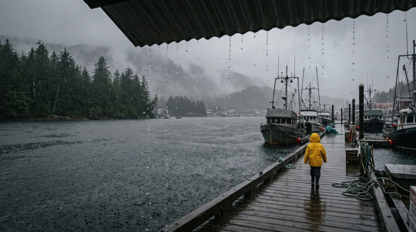
Ketchikan Weather: Rain, Temperature, Month by Month
Ketchikan Alaska weather comes down to one figure: 149.54 inches (3,798 mm) of rain a year, spread across 232.6 days with measurable precipitation. The National Weather Service 1991-2020 climate normal puts annual precipitation at 149.54 inches (3,798 mm), which is why this town is regularly called the wettest in the United States. That figure is not a disaster for visitors. It falls mostly as light, steady drizzle, the town is built around it, and the best indoor stops sit minutes from the cruise docks. This page turns the number into decisions: which month to pick, what to wear, what to do when it pours, and which weather claims no official source actually supports. For month-by-month planning beyond climate, see the best time to visit guide. Everything else a visit turns on is on everything a visit to Ketchikan turns on.
Quick answer The rain numbers, the extremes and what they mean for a visit
Ketchikan averages 149.54 inches (3,798 mm) of precipitation a year under the NWS 1991-2020 normals, with October the wettest month at 18.37 inches (467 mm) and June the driest at 7.02 inches (178 mm). Annual mean temperature is 46.0°F (7.8°C), with August the warmest month at 59.0°F (15.0°C) and January the coldest at 35.6°F (2.0°C). The wettest stretch lines up with October and November, after most cruise calls end, while the driest month sits at the heart of the season. Rain here is usually light and continuous rather than violent. Plan around things to do that work in any weather and read what to wear before you pack.
Key takeaways
- Annual precipitation runs 149.54 inches (3,798 mm), so a rain-free day is the exception and a plan for wet weather is part of the trip.
- October is the wettest month and June the driest, a pattern that shapes choosing your month.
- A hooded shell, quick-drying footwear and layers beat umbrellas and sneakers, which matters most on boat and floatplane trips.
- No official source confirms the famous "liquid sunshine" rain gauge, so treat attraction claims that mention it with care.
Rain, rain days and temperature, month by month
All three columns are the NOAA 1991-2020 climate normals for the Ketchikan airport station, USW00025325. Rain days count every day with at least 0.01 inches, which is why the figure is high even in the driest month: it rains often here, not hard.
| Month | Rain | Days with rain | Mean temp |
|---|---|---|---|
| January | 16.17 in (411 mm) | 22.0 | 2.0°C (35.6°F) |
| February | 11.80 in (300 mm) | 17.0 | 2.3°C (36.2°F) |
| March | 10.98 in (279 mm) | 20.6 | 3.3°C (38.0°F) |
| April | 10.25 in (260 mm) | 19.4 | 6.4°C (43.5°F) |
| May | 8.68 in (220 mm) | 16.1 | 10.1°C (50.1°F) |
| June | 7.02 in (178 mm) | 16.4 | 12.9°C (55.3°F) |
| July | 7.33 in (186 mm) | 16.0 | 14.9°C (58.8°F) |
| August | 11.30 in (287 mm) | 16.8 | 15.0°C (59.0°F) |
| September | 14.30 in (363 mm) | 19.5 | 12.0°C (53.6°F) |
| October | 18.37 in (467 mm) | 22.8 | 7.9°C (46.2°F) |
| November | 17.07 in (434 mm) | 23.6 | 4.3°C (39.7°F) |
| December | 16.27 in (413 mm) | 22.4 | 2.4°C (36.4°F) |
The year totals 149.54 inches (3,798 mm) across 232.6 days with measurable rain. NOAA also records a normal of 19.3 days a year with heavy fog, concentrated in the autumn and winter. Figures current for Q3 2026.
What 149.54 inches of rain actually does to your day
The number sounds apocalyptic. Annual precipitation of 149.54 inches (3,798 mm) is several times what most American cities see, and it is the figure behind the wettest-town reputation. What the number hides is how the rain arrives. In a climate like this the moisture usually comes as light drizzle that carries on for hours, not as a violent downpour that ends the day. You will get damp before you get soaked.
The town is engineered for it. Boardwalks, covered walkways, awnings and doors that open straight into overhangs exist because the rain is constant, not because it is dramatic. Walking Creek Street in a shower is a normal local activity, not a misfortune.
Three practical rules follow from the climate. First, a hooded shell beats an umbrella. Wind funnels along the waterfront and through the streets, and umbrellas turn inside out. A hood leaves both hands free. Second, bring footwear that can get wet and dry overnight. Sneakers and canvas shoes stay damp for days in this humidity.
Third, know your dry stops before the heavy band arrives. The Southeast Alaska Discovery Center sits at 50 Main Street, minutes from the docks, with entry at $5.00 per person from May through September and children 15 and under free with an adult. It is free from October through April. Most of the things to do in town are indoors or covered, so a wet day changes your route, not your trip.
The wettest month is October. The driest is June.
Most visitors assume the rainiest stretch is the middle of winter. The NOAA 1991-2020 normals say otherwise. October is the wettest month at 18.37 inches (467 mm), followed by November at 17.07 inches. June is the driest month at 7.02 inches (178 mm), with July close behind at 7.33 inches. The wet season is autumn, not deep winter.
Now line that up with the cruise calendar. The cruise season runs roughly May through September, with the peak in June through August. That means the season sits almost exactly on the driest part of the year, and the wettest months arrive after most ships have stopped calling. Visitors get the favorable end of the pattern without planning for it.
It still matters for choosing a month. June and July offer the lightest rain totals of the year along with the longest daylight. May and September take modestly more rain but bring fewer ships in port. October has the heaviest rainfall of any month, so a cruise call that late is the one itinerary where the weather odds genuinely worsen.
Our full best time to visit page weighs rain against daylight, crowds and wildlife timing. The short version for weather alone is this: aim for June, accept September, and pack seriously if you travel in October.
The temperature curve, and what is open
Mean daily temperature by month from the same NOAA normals, in Celsius with Fahrenheit underneath. The bands are the cruise calendar and the sales-tax table, not opinion.
Daylight runs from 17 hours 27 minutes on the June solstice to 7 hours 5 minutes on the December solstice.
What to wear: decisions, not a checklist
Decide on the outer layer first. In wind that funnels off the waterfront, a hooded waterproof shell is the only jacket that works all day. Umbrellas fail. Fleece alone soaks through. A shell with a real hood and taped seams covers you from the docks to the trailhead.
Decide on layers next. The annual mean temperature is 46.0°F (7.8°C), and even August averages only 59.0°F (15.0°C). That is not warm. Wear a midlayer you can pull on and off as you move between covered and open sections, because the temperature swings more with wind and cloud than with time of day.
Decide on footwear as a drying problem, not a style problem. Shoes will get wet. Pick something that dries overnight and grip well on wet boardwalk. Leave suede, canvas and thin-soled shoes behind.
Then add for the trip you booked. Boat and floatplane trips into Misty Fjords run on the water, where wind and spray drop the effective temperature well below the town figure. Bring a warm hat and gloves even in July, wear the shell as your top layer, and pack sunglasses, because the same sky that produces drizzle also produces sudden bright gaps. Dark windows help wildlife spotting, so skip pure white where you can. Every operator listing on our tour catalogue assumes you already dressed for rain.
Snow and the winter town
Winter in Ketchikan is cold, dark and wet, but not snowy in the way the interior of Alaska is. The official climate normals give January as the coldest month at an average of 35.6°F (2.0°C), with December close behind at 36.4°F (2.4°C). Those are averages hovering just above freezing, which is why precipitation falls largely as rain rather than snow for much of the winter. What the published normals we checked do not state is a monthly snowfall figure, average snow depth or the number of snowy days, so we cannot print those.
Daylight is short. The normals record January as the coldest month but say nothing about sunrise and sunset times, and we will not guess at them.
What stays open changes too. The Southeast Alaska Discovery Center is free from October through April. The Totem Heritage Center runs reduced hours, 1:00pm-5:00pm Monday through Friday from October through April, against daily openings in summer. Several seasonal attractions and tour operators pause entirely until the ships return.
There is one genuine winter advantage. The combined city and borough sales tax drops from 8.0% to 5.5% from October 1 through March 31, so everything you buy in the off season costs less at the register. Our costs page breaks the tax down.
The rain gauge we cannot confirm
Tourism blogs and marketing copy regularly mention a "Liquid Sunshine Gauge" in downtown Ketchikan, a novelty rain gauge that measures the town's famous rainfall for passing visitors. It appears in enough articles that many people arrive looking for it.
We checked for it. During this review we looked at the City of Ketchikan's pages, Ketchikan Gateway Borough pages, National Weather Service material and Visit Ketchikan, the destination marketing organization. No official public page on any of those sources mentions a rain gauge by that name or describes one downtown. The name surfaces in blog and tourism-marketing contexts only.
Because of that, we do not print it as a sight, we do not give it an address, and we do not list it among the town's attractions. It may well exist as a private or informal display. Nothing we can verify says so, and a guide that repeats marketing claims without an official source is not doing its job.
If photographing a rain gauge is on your list, treat it as unconfirmed and plan your day around the stops we can verify instead. The town's rain is real regardless, and the numbers on this page come straight from the National Weather Service and NOAA.
What still works when it is raining
Four trips that are not spoiled by weather, either because they are indoors, under cover, or because the rain is part of what you came to see. Prices and ratings are the platform’s own figures.
 from $109.95
Meal included
from $109.95
Meal included From Ketchikan: Crab Feast Lunch at World-Famous Lodge
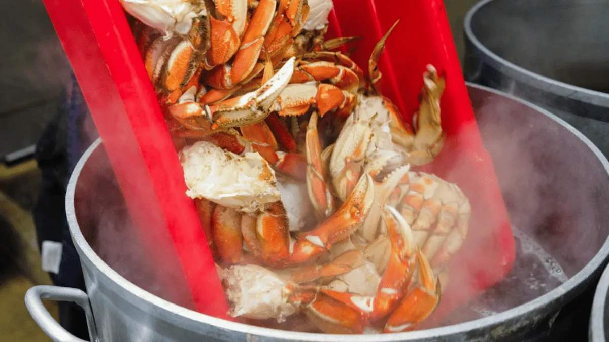
A coach ride south of town leads to George Inlet Lodge for a three-course lunch built around steamed Dungeness crab, with a host sharing stories about the old cannery building. Best for visitors who want a sit-down meal rather than a wildlife excursion.
Check Availability from $157.94
Meal included
from $157.94
Meal included Ketchikan: Lumberjack Show & Crab Feast
This stop in the Thomas Basin historic district pairs a competitive lumberjack show, chopping, sawing and log rolling, with an all-you-can-eat Dungeness crab feast next door at Harbor Haus. Good for groups who want entertainment and a full meal in one afternoon.
Check Availability from $84
Free cancellation
from $84
Free cancellation Ketchikan: Alaska Native Cultural and Scenic Shore Excursion
A Native-guided van tour run by Clan House Tours stops at four wildlife viewpoints and Totem Bight State Historical Park to cover Haida, Tlingit and Tsimshian history and craft. Fits travelers who want cultural context alongside a chance at spotting bears, salmon and eagles.
Check Availability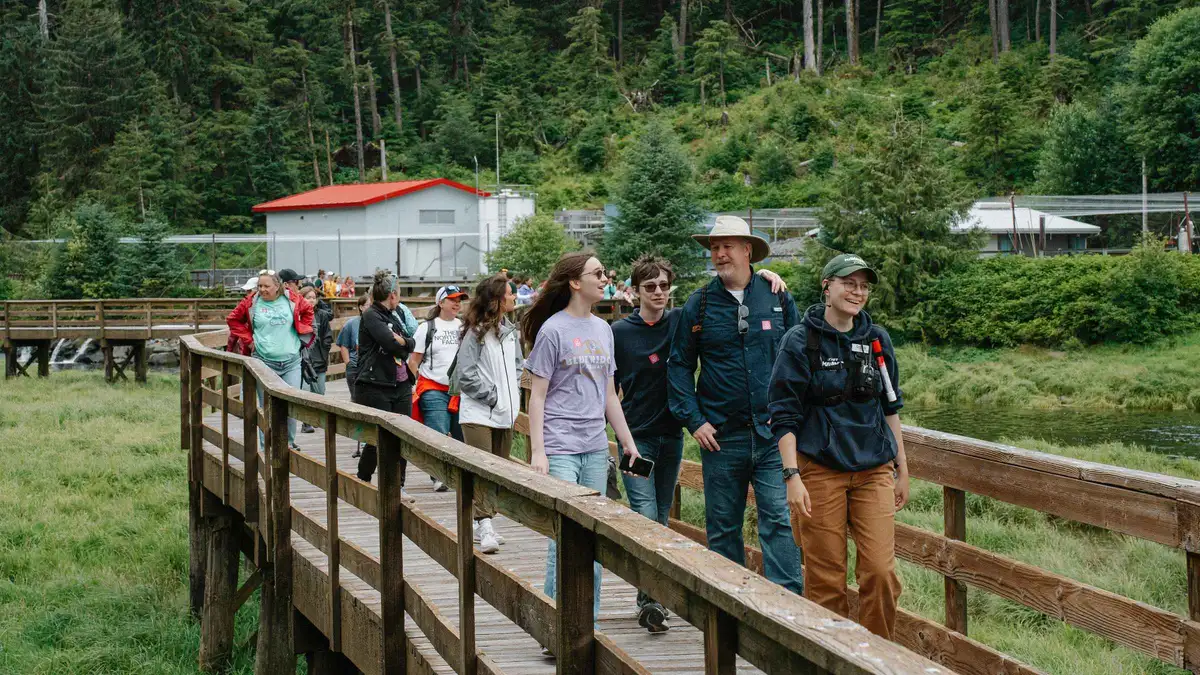 from $110
Free cancellation
from $110
Free cancellation Ketchikan: Alaska Rainforest Sanctuary and Totem Park Walk
A naturalist guide leads a walk through a private 40-acre rainforest reserve past an elevated boardwalk, a historic sawmill and a totem park, watching for eagles, bears and seals along Eagle Creek. Paced gently, so it suits most fitness levels rather than serious hikers.
Check AvailabilityPrices, ratings and details are the platform's own. dollar figures are the listed prices — the platform bills in your account's currency.
Next
Best time to visit
The month-by-month verdict, with the cruise calendar and the tax year on top of the climate: when to come to Ketchikan.
The decision this page feedsWhat a day costs
The seasonal sales tax, the park fees and the free list: what Ketchikan costs.
The wet months are the cheap monthsThings to do
Every place ranked, with the ones that stay dry marked: things to do in Ketchikan.
Where to go when it turns heavyKetchikan weather questions
How much rain does Ketchikan get in a year?
The NWS 1991-2020 climate normal puts annual precipitation at 149.54 inches (3,798 mm). That total is the sum of the twelve monthly normals published by NOAA for station USW00025325, which is why the town is often called the wettest in America. Most of it falls as light, steady drizzle rather than short violent downpours. Our what to wear section covers how to dress for it and our best time to visit guide shows how the rain spreads across the year.
What is the rainiest month in Ketchikan?
October, at 18.37 inches (467 mm) in the NOAA 1991-2020 normals. November is second at 17.07 inches. This surprises visitors who expect deep winter to be wettest. It matters for cruise planning because the season runs roughly May through September, so October sits just past the end of most calls. If your cruise does stop in October, build the day around covered and indoor stops from our things to do list.
What is the driest month to visit Ketchikan?
June, at 7.02 inches (178 mm), with July close behind at 7.33 inches. Both sit at the center of the cruise season, which means most visitors already arrive in the driest stretch of the year. Even the driest month here is wet by most standards, so waterproof footwear and a hooded shell stay in the bag year-round. Month-by-month trade-offs between rain, daylight and crowds are on our best time to visit page.
Does it snow much in Ketchikan?
Snowfall is modest by Alaska standards, but the official sources we checked do not publish a monthly snowfall normal, an average snow depth or a count of snowy days, so we will not print a figure. What the normals do show is why: January, the coldest month, averages 35.6°F (2.0°C), hovering just above freezing, so winter precipitation often falls as rain. Winter temperatures and the off-season sales tax drop are covered in our snow and winter section above.
What is the temperature in Ketchikan in summer?
Mild, not hot. August is the warmest month in the NOAA 1991-2020 normals at an average of 59.0°F (15.0°C), and July averages 58.8°F (14.9°C). The annual mean is 46.0°F (7.8°C). On the water, wind and spray make it feel colder still, so bring a warm hat and a midlayer even on a summer Misty Fjords trip. Pack for cool and damp rather than warm and sunny, and check tour options for what each operator supplies.
Is the Liquid Sunshine rain gauge in Ketchikan real?
We cannot confirm it. The name appears in tourism blogs and marketing copy, but no City of Ketchikan, borough, National Weather Service or Visit Ketchikan page we checked mentions a downtown rain gauge by that name. Because no official source describes it, we do not list it as a sight or give it an address. Plan around verified indoor stops instead, such as the Southeast Alaska Discovery Center, which charges $5.00 per person from May through September and is free from October through April.
Ketchikan weather on video
Three port-day films shot in ordinary Ketchikan weather, which is the most useful thing a forecast cannot show you.
11 Amazing Things You MUST Do in Ketchikan, Alaska
A full day ashore in typical conditions, which is what the normals above look like in practice.
Video: Art We There Yet?Everything to Know Before You Cruise Ketchikan Alaska!
Covers what to wear and what the weather does to a port call.
Video: Christine LozadaWhat to Do in Ketchikan Alaska on a Cruise Port Day
The town and the totem parks, filmed wet.
Video: Take2TravelLinked as published on YouTube. We have no connection to these channels.
We may earn a commission if you book through one of our links, at no extra cost to you. Full affiliate disclosure