 Ketchikan City Guide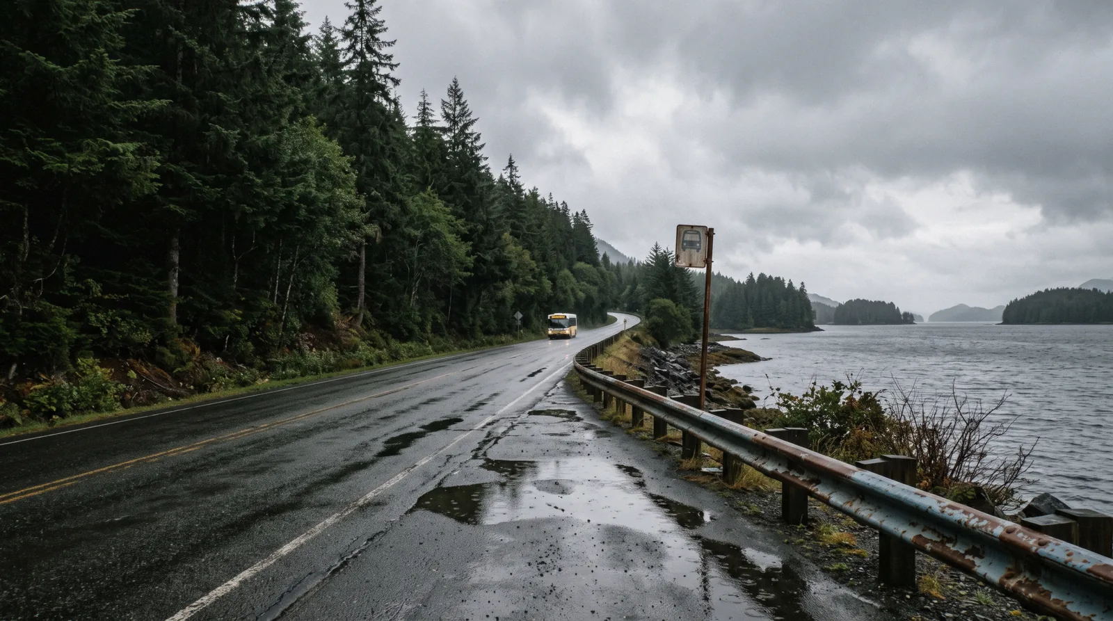
Getting Around Ketchikan
Getting around Ketchikan is a question of limits as much as routes. The downtown core is small enough to cover on foot, the borough bus costs $2.00 a ride, and no official source publishes taxi or rideshare coverage. The road system runs a short way north and a short way south and connects to nothing, so travel past the pavement means a boat or a plane. This page prints what the official sources say, and says plainly where they say nothing. For arrival logistics, see getting there. The town all of this sits in is the Ketchikan guide behind these routes.
Quick answer Walk downtown, ride the $2.00 bus, book boats and planes for the rest.
Getting around Ketchikan splits into three tiers. The downtown core, from the cruise berths to Creek Street, is walkable, though the Port of Ketchikan publishes no walking times. The Ketchikan Gateway Borough bus charges $2.00 per adult ride, with a $5.00 digital day pass through the Token Transit app. Past the pavement there is no road: Misty Fjords National Monument is reachable only by boat or floatplane via Behm Canal. No official municipal page enumerates taxi companies or confirms Uber or Lyft coverage in town.
Key takeaways
- The borough bus adult fare is $2.00, or a $5.00 digital day pass, paid with exact change or the Token Transit app.
- The Port of Ketchikan does not publish walking times from its berths to downtown sights.
- Taxis and rideshare are a real gap, so read the taxi section before you land.
- Anything beyond the paved road, like Neets Bay, is a boat or a plane.
Ketchikan on foot
Downtown Ketchikan is a genuine walking town. The four cruise berths line the downtown waterfront in a row, numbered I to IV from south to north, so stepping off any of them puts you on the same narrow strip of Front Street within a minute or two of the shops, the cruise port welcome infrastructure and the museum buildings. Creek Street, the historic boardwalk over Ketchikan Creek, sits at the quiet end of downtown. The official Port of Ketchikan page does not state a walking distance or walking time from the berths to Creek Street. The city publishes berth layouts, not pedestrian estimates, so plan by look at a map rather than by a published figure.
One climb catches people out. The streets behind the waterfront rise quickly toward Deer Mountain, and the Married Man's Trail, which leaves the northeast end of Creek Street and follows the creek upstream on stairs and boardwalk, gains about 100 feet in roughly a fifth of a mile according to secondary sources. No official city or Forest Service page describes that trail at all, so treat any figure attached to it as unofficial.
Practical points for walking: the boardwalk at Creek Street is free and public, rain is the default rather than the exception, and sidewalks along the main drag are short. For a walking-first day plan, see our page on Ketchikan without a tour. Wear real shoes with grip. The boardwalk and the stairs get slick, and the town does not flatten out for you because a ship is in.
The borough bus
Ketchikan Gateway Borough Transit, known simply as The Bus, runs the fixed routes in town. The published fares are simple. An adult aged 19 to 59 pays $2.00 per ride. Youth and senior riders pay half of that. If you expect to ride more than twice, the Token Transit app sells a digital day pass for $5.00. For longer stays, a monthly unlimited pass costs $25.00 and an annual unlimited pass costs $179.00. You can pay with cash, but it must be exact change, or with the Token Transit app. There is no on-board change-making and no paper pass system described on the borough fare page.
What the routes reach matters more than what they cost. The bus runs along the corridors where people actually are, which for a visitor means the highway north toward Totem Bight State Historical Park at milepost 10 of North Tongass Highway, and the way south toward Saxman Native Village. Both sit on the road system, which is exactly why they are the two totem sites a bus rider can realistically reach without a tour. The park charges a $5.00 per person day-use entry fee on top of the fare.
Be honest with yourself about the math. A bus plan and a short ship call fight each other. Cruise calls run a handful of hours, the bus does not run on your ship's schedule, and waiting for a return ride eats the clock fast. If your ship is in for most of a day and you only want one destination, the bus can work. If your call is short, walking downtown or a booked tour with pier pickup is the realistic option. Fare figures here come from the borough's official fare page.
Two things the borough publishes that almost nobody repeats. The first is a Free Downtown Shuttle Zone: a Bus+ service running inside the downtown zone, roughly from Bryant Street to the Coast Guard Base, daily through the summer season and on cruise-ship days into late October. Inside that zone there is no fare at all. If your ship is at a downtown berth and you only want to move along the waterfront, that is your answer.
The second is the rest of the fare table. A single ride is $2.00 for an adult aged 19 to 59, but $1.00 for anyone 18 or under and $1.00 for anyone 60 or over, and it is free for an ADA paratransit cardholder. The day pass is $5.00, or $2.50 at the senior and youth rate. Longer stays have their own tiers: a 25-ride punch pass at $20.00, a month unlimited at $25.00, six months at $125.00 and a year at $179.00. Pay cash with exact change or use the Token Transit app.
Every published transport fare in Ketchikan
All of it comes from the Ketchikan Gateway Borough transit fare page and the borough airport ferry page. There is no city-wide travel pass and no published taxi tariff, so this is the whole list.
| What | Fare | Who it is for | Where it goes |
|---|---|---|---|
| Free Downtown Shuttle Zone | Free | Anyone | Inside the downtown zone, roughly Bryant Street to the Coast Guard Base |
| Bus, single ride | $2.00 adult, $1.00 youth or senior, ADA free | Anyone with exact change or the app | The fixed route, north and south |
| Bus day pass | $5.00, or $2.50 senior and youth | A day out to the totem parks | Unlimited on the fixed route |
| 25-ride punch pass | $20.00 | A long stay | Unlimited within the punches |
| Airport ferry | $6.00 adult, $7.00 vehicle, one way | Anyone flying in or out | Gravina Island, across the Narrows |
Figures current for Q3 2026.
The road itself
Ketchikan's road system runs a short way north and a short way south along Tongass Highway, and then it stops. It connects to no other town, no highway, and no mainland network. Ketchikan is a road-limited island community, reachable by air and sea only. How long the road system is in miles is a figure no official source publishes. We checked the borough's own Roads page. The length is not stated there or anywhere else on an official site, so we print that instead of a number.
That fact shapes what renting a car gets you. A rental car cannot take you to another community. It cannot reach most of the places visitors actually want, because the marquee destinations sit beyond the pavement. What the road does reach is the string of sights along North Tongass Highway, including Herring Cove and the rainforest preserve area at its end, plus Totem Bight and the park at milepost 10. A car is worth it for three cases. One, you are staying several days rather than calling by ship. Two, you want to control your own timing at multiple highway stops in one day. Three, rain is hammering down and you would rather sit in a dry car than wait at a bus stop.
For everything else, treat a rental as a local errand tool, not an exploration tool. Beyond the pavement, your options are tours with vehicle transfers, and the boat-and-plane trips described on our day trips page. If your time is one ship call, compare a guided option on our tours catalogue before renting anything.
Off the road: boat or plane
Everything past the pavement is a boat or a plane. This is not a marketing line, it is the access situation stated by the land managers themselves.
Misty Fjords National Monument, a 2,142,243-acre US Forest Service wilderness east of town, sits roughly 22 to 40 miles out by water and is reachable only by boat or floatplane via Behm Canal. The Forest Service states no entrance fee for the monument, but getting there means booking a flightseeing or boat operator, since there is no road and no self-drive option. Flightseeing operators fly under FAA on-demand air taxi certificates, and the Forest Service requires commercial guides on Tongass lands to hold a special use permit.
The same rule applies to wildlife sites. Neets Bay, home to the SSRAA salmon hatchery and its seasonal black bear viewing, is road-inaccessible and reached by chartered floatplane flights during the late summer run. There is no published public access permit from SSRAA, so access is a tour arrangement. Even places that feel close, like the coves along Behm Canal, are boat trips.
The practical takeaway: budget for tours, not fuel. Browse Misty Fjords tours and bear viewing at Neets Bay to see what off-road access actually costs.
When the road is not enough
Four trips that go where the bus does not, two of them on the road system and two off it. Prices, ratings and durations are the platform’s own figures.
 from $85
Free cancellation
from $85
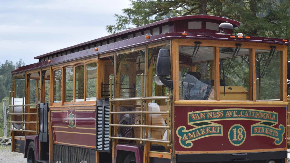
Free cancellation Ketchikan: Totem Pole, Wildlife & City Trolley Tour
An open-sided San Francisco style trolley tours Saxman Native Village's carved totem poles and carving shed, then continues to Herring Cove for a chance at eagles, seals and bears. A shorter option for travelers who mainly want the totem poles and a quick wildlife stop.
Check Availability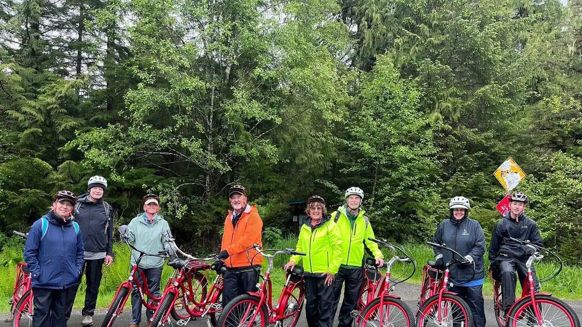 from $164
Pickup available
from $164
Pickup available Ketchikan: E-Bike and Hike Tour
Riders pedal e-bikes eleven miles to the edge of the road system, then hike into the Tongass National Forest to a waterfall. The day ends with smoked salmon at the marina, a fit for visitors wanting light exercise over a bus tour.
Check Availability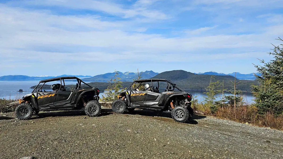 from $275
Free cancellation
from $275
Free cancellation Ketchikan: Adventure Kart Expedition
Guests drive their own 2024 Polaris RZR through logged mountain trails above Ketchikan, with views of the Behm Canal and Tongass National Forest along the route. Meant for travelers who want an active, hands-on ride rather than a seated van or boat tour.
Check Availability from $135
Small group
from $135
Small group Ketchikan Photo Safari
A local photographer guides small groups through Creek Street, Ketchikan Creek and Potlatch Totem Park, teaching composition and framing along the way. Suited to travelers who want photo coaching built into their sightseeing rather than a straight wildlife or cultural tour.
Check AvailabilityPrices, ratings and details are the platform's own. dollar figures are the listed prices — the platform bills in your account's currency.
Next
Getting there
The airport on the other island, the state ferry and the flights: how to get to Ketchikan.
Before the bus mattersThings to do
What the bus route actually reaches: things to do in Ketchikan.
The list this page servesGetting around Ketchikan: questions
How do I get from the Ketchikan cruise docks to downtown on foot?
The four downtown berths sit in a row along the waterfront, numbered I to IV from south to north, so every one of them fronts the downtown strip. The Port of Ketchikan does not publish a walking distance or walking time from the berths to Creek Street or any other sight, so no official figure exists. Plan by map and expect a flat, short walk along Front Street. For berth-by-berth detail, see our cruise port page.
How much does the Ketchikan bus cost and how do I pay?
The Ketchikan Gateway Borough bus charges $2.00 per adult ride for riders aged 19 to 59, with youth and senior riders at half fare. Pay with exact change or with the Token Transit app, which also sells a $5.00 digital day pass. A monthly unlimited pass is $25.00 and an annual pass is $179.00. Payment details come from the borough's official fare page, and more practical costs are on our costs page.
Can I take the Ketchikan bus to Totem Bight State Historical Park?
Totem Bight sits at milepost 10 on North Tongass Highway, on the borough's paved road system, so it is the kind of destination the bus corridors serve. The park charges a $5.00 per person day-use entry fee, open year-round from 7:00am to 6:00pm with free parking. Check the borough transit schedule for stop locations and times before you commit, because a short ship call and a bus timetable do not always fit together. See our Totem Bight page.
Does Uber or Lyft operate in Ketchikan?
No official municipal page confirms Uber or Lyft coverage in Ketchikan, and none enumerates the taxi companies either. Because no official source states it, we cannot confirm either app operates here. Do not build your day around hailing a ride from an app. If you need a taxi, find one near the downtown berths or ask at the Visitors Bureau at 131 Front St. Our getting around page explains what this gap means for planning.
Can I rent a car in Ketchikan and drive somewhere else?
You can rent a car, but it will not take you anywhere else. The road system runs a short distance north and south and connects to no other town or highway. No official source publishes the total road mileage, not even the borough's own Roads page. A car makes sense for multi-day stays and for timing several highway stops in one day, such as Herring Cove. For trips beyond the pavement, see our day trips page.
How do I reach Neets Bay or Misty Fjords without a road?
By boat or floatplane, and only that way. The US Forest Service states Misty Fjords National Monument is reachable only by boat or floatplane via Behm Canal. Neets Bay is road-inaccessible and served by seasonal chartered flightseeing flights, with no published public access permit from the hatchery operator. Both mean booking a tour with pier transfer. Compare options on our Misty Fjords and Neets Bay bear viewing pages.
Moving about on video
Three films that show the distances, the bus and the walk from the berths.
What to Do in Ketchikan Alaska on a Cruise Port Day
A port day covered on foot and by trolley.
Video: Take2Travel11 Amazing Things You MUST Do in Ketchikan, Alaska
Shows how far the totem parks really are.
Video: Art We There Yet?Ketchikan, Alaska Cruise Port Guide
The waterfront and the walk off the dock.
Video: The Port LowdownLinked as published on YouTube. We have no connection to these channels.
We may earn a commission if you book through one of our links, at no extra cost to you. Full affiliate disclosure